FORECAST HIGHLIGHTS
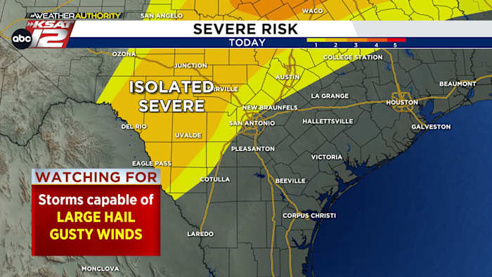
SATURDAY STORMS: Possible near Rio Grande
HEAT INDEX 102°+: Humidity will push heat indices above 100° daily through Monday
FRONT TUESDAY: Lower humidity & temps by Wednesday
FORECAST
We’ve now experienced four days in a row of record heat, but some relief is on the way next week.
ISOLATED STORMS
Instability could lead to a few storms in the Hill Country and near the Rio Grande Saturday afternoon and evening. Isolated severe storms with large hail and high winds can’t be ruled out, but any storms that happen to develop should significantly weaken before hitting San Antonio. There’s just an outside chance that San Antonio could get leftovers late Saturday evening.
TEMPERATURE & HUMIDITY
Plan for more of the same this weekend and to start next week. With afternoon temperatures well into the 90s combined with high humidity making it feel like 102-106°.
A FRONT?!
Yes… but, know this time of year our cold fronts aren’t particularly strong. That said, we’ll enjoy some lower humidity and lower temperatures by Wednesday. Morning lows will return to the lower 60s, while afternoon highs return to near 90°.
QUICK WEATHER LINKS
Copyright 2025 by KSAT – All rights reserved.


