FORECAST HIGHLIGHTS
QUIET TODAY: Partly cloudy and warm for Thursday
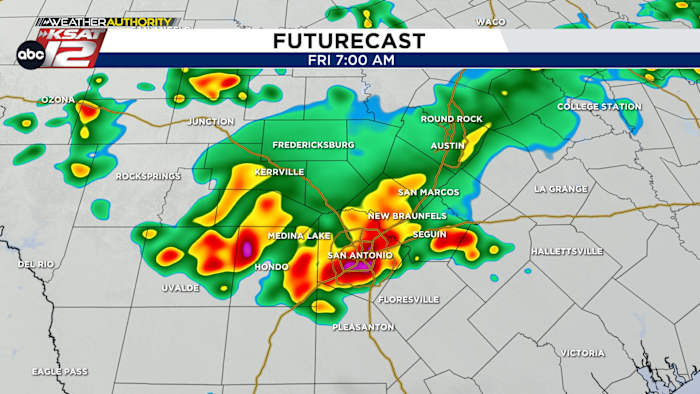
STORMS TONIGHT: A round of storms tonight, early on Friday
FEW SHOWERS THIS WEEKEND: Mainly for those south of I-10
FORECAST
The end of May has been good to us. Heavy rainfall has put a dent (a small one) in our drought situation. Could we see more? There’s a decent shot at more storms overnight.
QUIET TODAY
We don’t expect much action on your Thursday. While we can’t rule out a stray storm or two, most of the day will be spent under partly cloudy skies and quiet conditions.
STORMS TONIGHT
Showers and storms will gather across West Texas this afternoon. The upper level flow will take that activity and push it south and east towards our area tonight, along with a weak cold front. As of now, the arrival of storms would be just before sunrise tomorrow. However, timing with these systems can often change and it’ll all depend on how storms evolve to our north today. We’ll be watching.
Severe weather is possible with this round of storms, along with the threat of a bit more street flooding.
FRIDAY
Once the storms, along with a weak front, pass us by, we’ll see quieter conditions for much of Friday. The one exception would be areas south of San Antonio which may see a few more isolated storms.
THIS WEEKEND
Saturday and Sunday will bring more cloud cover thanks to a potential tropical connection. A developing tropical system in the Pacific will move north along the coast of Mexico. Eventually, some of that tropical moisture will make a run at South Texas. Most of the deep moisture will remain south of us, but a few showers can’t be ruled out as a result. Otherwise, it’ll be warm and humid this weekend.
QUICK WEATHER LINKS
Copyright 2025 by KSAT – All rights reserved.


